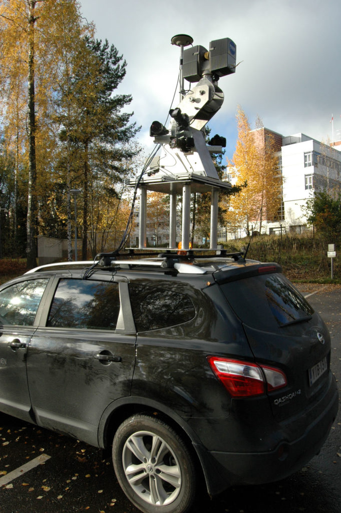
The ROAMER mobile laser scanning system has been developed at FGI. It can be seen on top of a vehicle in its up-to-date configuration in the image (left). ROAMER is a high-end surveying device for producing accurate, dense, and precise point clouds for three-dimensional mapping for the detection, localization, modeling, analysis, and monitoring of anthropogenic and natural phenomena and processes. What is unique in the ROAMER construct are the high-speed scanner and possibility to adjust the scanning angle for application. The system is also easy to operate in terms of data recording facilities and mountability, which is shown by numerous study cases. ROAMER provides microscale 3D data at 20 mm absolute accuracy level at point densities up to 10 000/m2 for mapping of large areas effectively. ROAMER data contains high detail 3D points for mapping and modeling of urban area, roads, forests and parks, terrain topography, and change detection.
ROAMER Mobile laser scanning system: A Unique high-speed scanner with an adjustable angle