A novel low-cost multi-sensor mobile laser scanning system has been developed at FGI CoE-LaSR by Anttoni Jaakkola. This work is the focus of his Dr. Sc. thesis, presented in the public examination on 5th June 2015 (Press release in Finnish).
“The results show that mobile laser scanning is a feasible method for various applications of mapping the environment and that even a low-cost system can perform sufficiently in these measurements” Anttoni Jaakkola concludes.
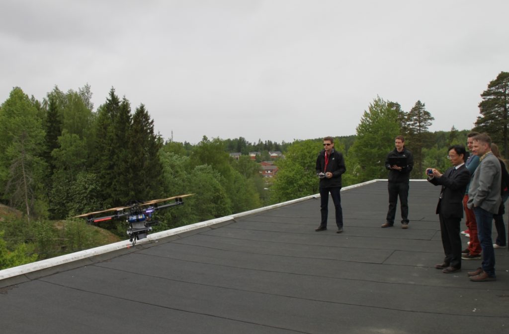
The developed system has been demonstrated on car and UAV (umanned aerial vehicle) platforms. It allows recognizing and classifying different features in the scanned environment, i.e. those of trees, roads and snow depth more accurately compared to the formerly used systems.
With future advances of laser scanning and positioning technologies, it can be expected that price of these systems will further decrease. Widespread adoption of laser scanners, especially in the automotive industry and the new global navigation satellite systems, will significantly reduce the cost of mobile laser scanning components. Nowadays expensive mobile laser scanning systems are almost exclusively owned by mapping companies as benefits of using them requires high rates of utilization and applications with high added-value.
“With future cost reduction, mobile laser scanning will expand to new fields, as also other companies can afford to acquire such systems and utilize them in various applications.” Jaakkola foresees.
Mobile laser scanning is a measurement technology that combines accurate positioning and attitude information from navigation satellites and inertial sensors with distance measurements from a laser scanner into a point cloud that represents the geometry of the environment surrounding the measurement platform. This geometrical information can be utilized in a variety of applications ranging from 3D city modelling and infrastructure maintenance to forestry and environmental monitoring.
Picture: Anttoni Jaakkola (left) demonstrating the UAV mobile laser scanning system
More information: Senior Research Scientist Anttoni Jaakkola, anttoni.jaakkola(at)nls.fi, tel 358 50 3498 108
Dr.Sc. thesis Low-cost Mobile Laser Scanning and its Feasibility for Environmental Mapping https://aaltodoc.aalto.fi/handle/123456789/16212