We create new knowledge, science, openings and breakthroughs in the emerging field of laser scanning at the Finnish Geospatial Research Institute FGI.
The Centre of Excellence in Laser Scanning Research CoE-LaSR existed between 2014-2019 and was funded from Academy of Finland Centres of Excellence programme. The laser scanning research and development work is ongoing in our new projects.
We are continuously looking for new academic partnerships and business collaboration
Interested in a career in developing laser scanning technology?
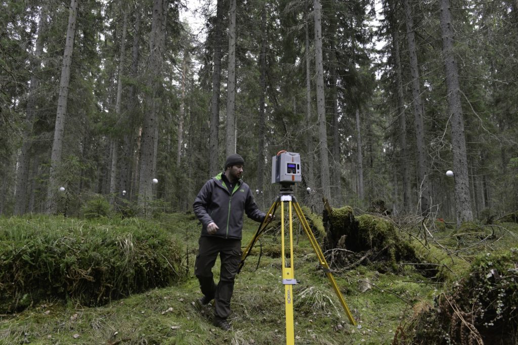
On this video Dr Mariana Campos sets up a permanent laser scanning station in the premises of the Finnish geospatial research institute FGI, to monitor small phenological changes in the forest.
No Results Found
The page you requested could not be found. Try refining your search, or use the navigation above to locate the post.
Capturing Urban Data with Backpack Laser Scanning
Personal mobile mapping on a backpack (PLS) is a novel innovation from FGI. The application uses various technologies: GNSS-IMU positioning, laser scanning, digital photography and data driven algorithms for improving the positioning in often GNSS denied urban space....
Laser Scanner in a Backpack – The Evolution towards All-terrain Personal Laser Scanners
Personal laser scanners (PLS) lead the way towards compact, agile and flexible solutions for mapping complex environments and challenging locations, such as rugged terrain and complicated urban structures. Our Akhka R2 backpack laser scanning system allows the...
Next generation forest management: High detail information from laser scanning
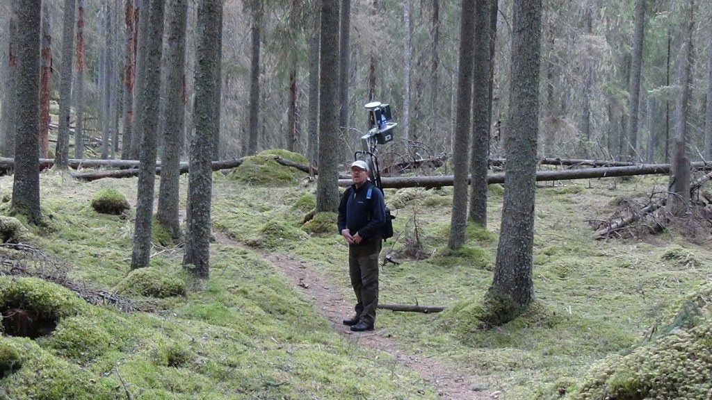
Picture above: Preparing to collect terrestrial laser scanning data from old Norway spruce forest. High detail remote sensing technologies, especially laser scanning, and their ability to measure 3D structure of the forest have revolutionized forest mapping and...
laser scanning network
Our networks around the world