World’s first miniature unmanned aerial vehicle (mini-UAV) based laser scanner
The first mini-UAV (FGI Sensei) including the laser scanner, intensity recording, spectrometer, thermal camera, and conventional digital camera has been developed at FGI in 2009 (see Jaakkola et al. 2010). Recently, the work on the mini-UAV has...
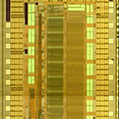
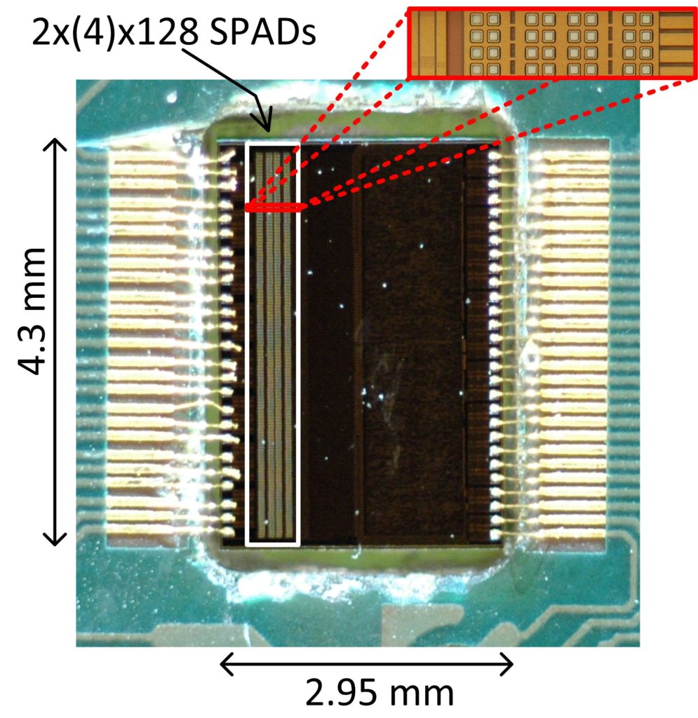
Single photon laser radar enables improved performance and miniaturization of radars
A first realization of a novel pulsed time-of-flight laser radar has been actualized by the CoE Oulu group. What makes the radar unique is that it is based on high speed (FWHM ~100ps) and high energy (~1nJ) optical transmitter pulses produced with a specific laser...
Improved Raman spectroscopy system: Many fields of application
The development of time-gated Raman spectrometer system by CoE Oulu group suggest CMOS SPAD based time-gating techniques could pave way to the better use of the high resolving power of Raman spectrometer techniques. Their potential fields of application are in...
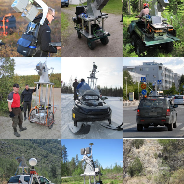
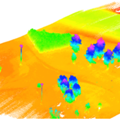
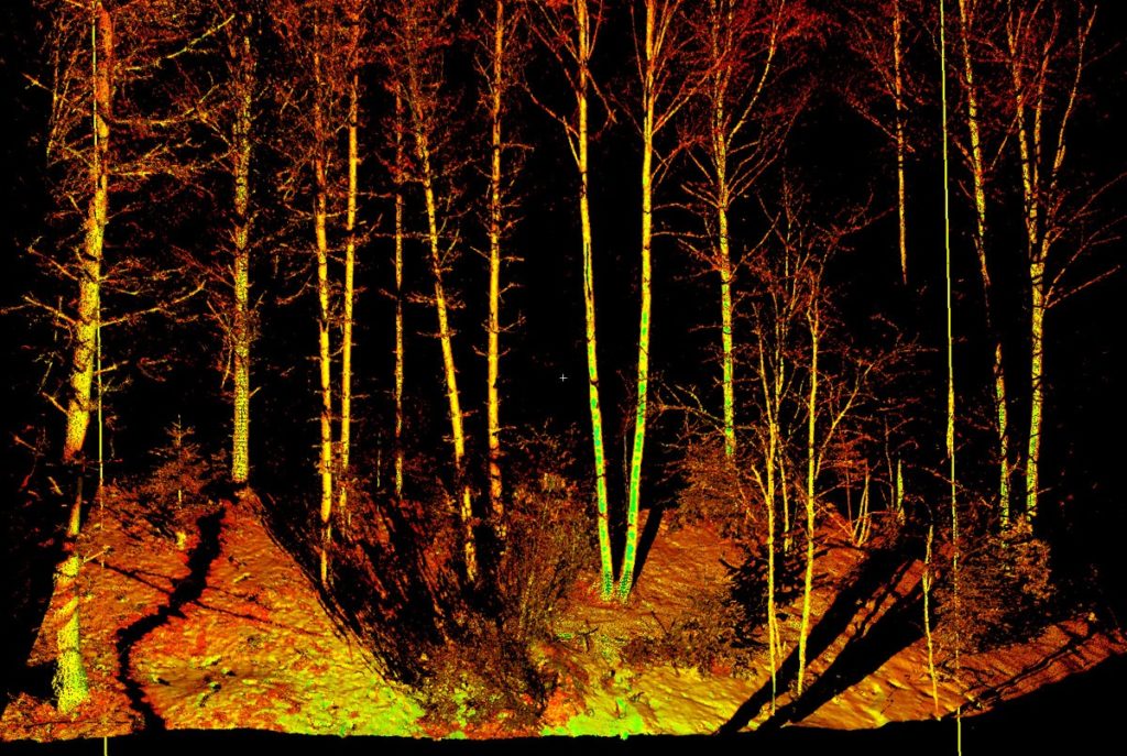
Multiplatform Mobile Laser Scanning (MLS)
Mobile laser scanning is an emerging technology capable of capturing three-dimensional data from surrounding objects. With state-of-the-art sensors, the achieved point clouds capture object details with good accuracy and precision. Many of the applications involve...
Operational forest inventory since 2008/2010
Today, the standwise forest inventory in Finland is based on airborne laser scanning, the research of which was started by Juha Hyyppä in 1997 in Finland (profiling waveform radar signal of forests studied in 1987-1996). As a result of co-operation of J. Hyyppä and...
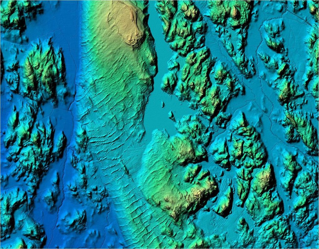
National Laser Scanning Finland and Sweden since 2008
An increasing number of countries are applying airborne laser scanning (ALS) for national or statewide elevation modeling (e.g. The Netherlands, Switzerland, Finland, Sweden, Austria, Germany, US). In Finland, the technology was transferred from research done by...
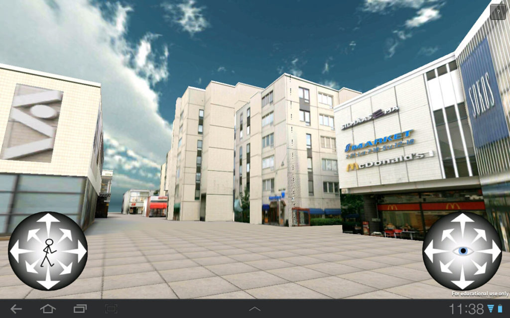
Tapiola 3D: The first whole-process Laser Scanning from hardware to virtual reality in built environment in 3D game engine
FGI demonstrated in November 2011 the full processing chain from hardware electronics to geometrically correct virtual 3D model in Tapiola region usable in 3D game engine in a smart phone. The demo is downloadable from Google Play store (3D Tapiola). The main...
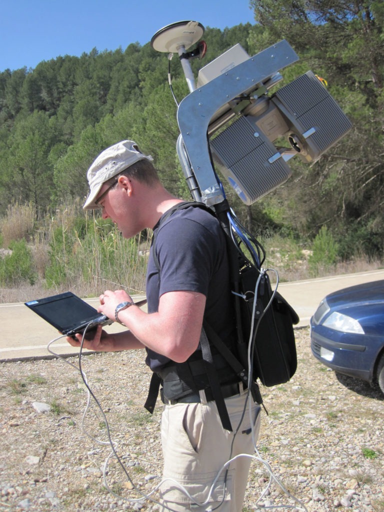
Akhka: The first backpack high-end MLS presents unique mobility and ease of use in rugged terrain
A whole new approach for mobile laser scanning (MLS) was innovated and built to meet the challenges of mobility in marshlands and rugged terrains, but suitable also for narrow city passages and indoors. AKHKA system was designed to be operable by one person as a...
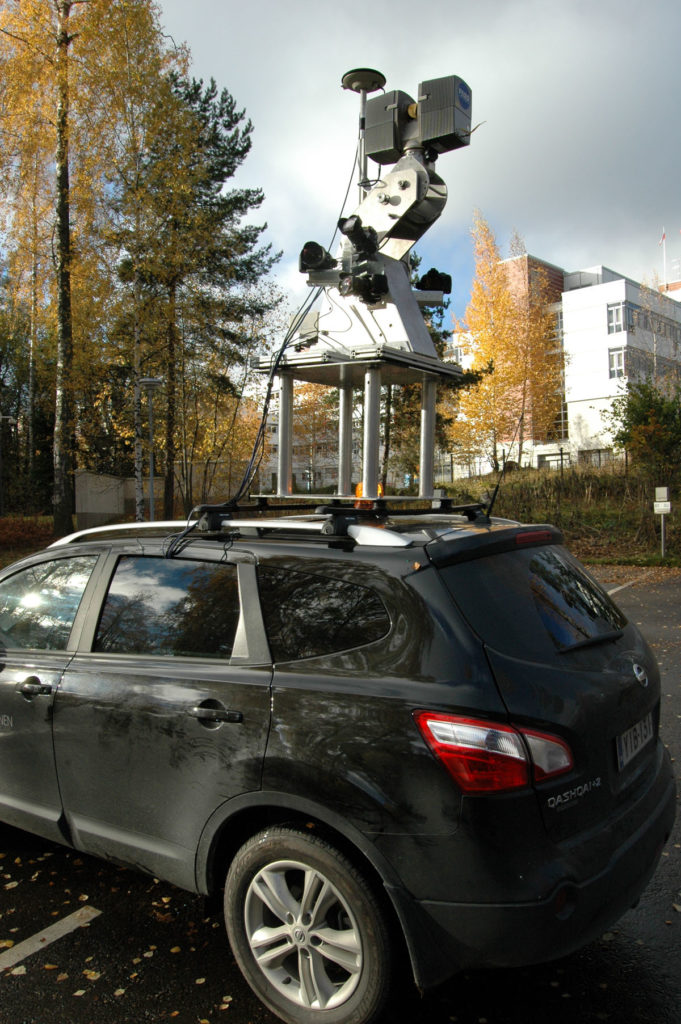
ROAMER Mobile laser scanning system: A Unique high-speed scanner with an adjustable angle
The ROAMER mobile laser scanning system has been developed at FGI. It can be seen on top of a vehicle in its up-to-date configuration in the image (left). ROAMER is a high-end surveying device for producing accurate, dense, and precise point clouds for...