We create new knowledge, science, openings and breakthroughs in the emerging field of laser scanning at the Finnish Geospatial Research Institute FGI.
The Centre of Excellence in Laser Scanning Research CoE-LaSR existed between 2014-2019 and was funded from Academy of Finland Centres of Excellence programme. The laser scanning research and development work is ongoing in our new projects.
We are continuously looking for new academic partnerships and business collaboration
Interested in a career in developing laser scanning technology?
On this video Dr Mariana Campos sets up a permanent laser scanning station in the premises of the Finnish geospatial research institute FGI, to monitor small phenological changes in the forest.
CoE -LaSR -researcher appointed as Assistant Professor at Aalto University
One of our post doc researchers, Matti Vaaja, has been appointed Assistant Professor at Aalto University’s Department of Built Environment. (1.8.2017-31.7.2022.) This is a great success for the Centre of Excellence as our aim is to boost knowledge based growth...
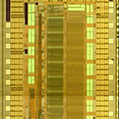
Single photon laser radar enables improved performance and miniaturization of radars
A first realization of a novel pulsed time-of-flight laser radar has been actualized by the CoE Oulu group. What makes the radar unique is that it is based on high speed (FWHM ~100ps) and high energy (~1nJ) optical transmitter pulses produced with a specific laser...
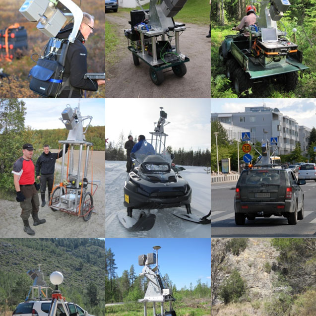
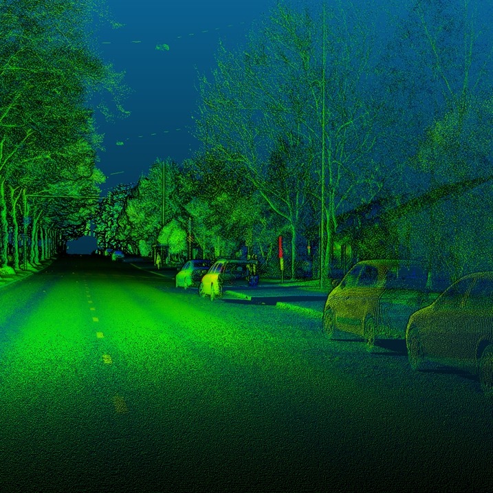
Multiplatform Mobile Laser Scanning (MLS)
Mobile laser scanning is an emerging technology capable of capturing three-dimensional data from surrounding objects. With state-of-the-art sensors, the achieved point clouds capture object details with good accuracy and precision. Many of the applications involve...
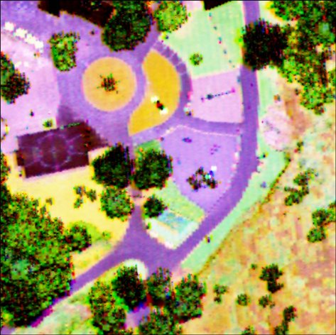
Research to advance precision forestry
3D precision forestry is one of the main tasks in CoE-LaSR, which the partners have strongly focused on since 2007. During 2014-2016 all major players in forest sector in Finland have taken 3D precision forestry as one of their core development tasks....
Intensity calibration has led to Multispectral Laser Scanning
In laser scanning, intensity value is often recorded for each point – in addition to point cloud x,y,z information. The need for radiometric calibration of the laser scanning intensity stems from the possibility of using calibrated intensity as additional feature for...
CoE-LaSR seminar: Laser scanning in forestry – from science to operational applications
Collaboration between researchers from the Department of Forest Sciences (University of Helsinki) and end users from industry, consulting, and governmental organizations, for example, has been one of the main aims when developing forest applications within the Centre...
laser scanning network
Our networks around the world